In the recent years Metro Manila has been plagued by flooding. To this day the disaster that Typhoon Ondoy (Typhoon Ketsana) and habagat (southwest monsoon) brought to Metro Manila has left it scarred and scared of a similar occurrence.
Then there’s Tropical Storm Mario (Typhoon Fung-Wong) who visited the Philippines with only 3 months left in 2014.
Classes and government offices may be the first to get suspended, however, those working in the private sector may not be so lucky. As a result, those working in offices around Metro Manila have to go through the hellish combination of floods and traffic while traveling to and from their homes.
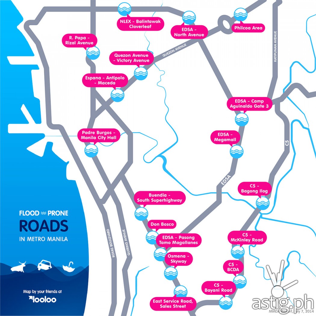
Using data provided by the Metro Manila Development Authority (MMDA), The folks over at looloo created an infographic showing the the most flooded-prone roads in Metro Manila, shown below.
Infographic: 18 of the most flood-prone roads in Metro Manila according to MMDA
Click on the image to get a larger view

The most prone-flood areas can be sub-divided into 5 locations: EDSA, C5, Quezon City, Manila City, and Makati.
EDSA
- EDSA – North Avenue
- EDSA – Camp Aguinaldo Gate 3
- ESDA – Megamall
- EDSA – Pasong Tamo Magallanes
C5
- C5 – Bagong Ilog
- C5 – McKinley Road
- C5 – BCDA
- C5 – Bayani Road
Quezon City
- Philcoa Area
- NLEX – Balintawak Cloverleaf
- Quezon Avenue – Victory Avenue
Manila City
- R. Papa – Rizal Avenue
- España – Antipolo – Maceda
- Padre Burgos – Manila City Hall
- East Service Road, Sales Street
Makati
- Buendia – South Superhighway
- Don Bosco
- Osmeña Skyway
Unfortunately for a majority of commuters and drivers, it is unavoidable to pass through these major areas when moving through Metro Manila. Most of the roads listed are major highways, especially C5 and EDSA.
Until the flooding and traffic situation becomes better (assuming it will) it is still best to remain indoors and avoid flooded areas during a storm.

